Let the fun begin! Tropical Depression 1
Moderators: carlson1, Charles L. Cotton
Re: Let the fun begin! Tropical Depression 1
It can happen here.

Re: Let the fun begin! Tropical Depression 1
Unfortunately, GFS is one of the more reliable dynamic models.
Edit, looks like my pony is slow
Edit, looks like my pony is slow
"All bleeding eventually stops.......quit whining!"
-
gregthehand

- Senior Member
- Posts: 1399
- Joined: Tue Oct 17, 2006 5:48 pm
- Location: NW Houston, TX
Re: Let the fun begin! Tropical Depression 1
It looks like it's going to go in at Harlingen/Brownsville and then head west. Here in Houston we'll probably just get a lot of rain.
- Attachments
-
My posts on this website are worth every cent you paid me for them.
Re: Let the fun begin! Tropical Depression 1
Keep on your toes, significat deviations from the forecasts have happened in the past.
This consensus forecast has narrowed in on the region near the Texas/Mexico border as being the most likely landfall location, with the usual cone of uncertainty surrounding it. The northernmost landfall location is Port O'Connor, as predicted by the Canadian model. The southernmost landfall location is near Tampico, Mexico, as predicted by the ECMWF model. Alex's landfall time varies from Wednesday evening to Thursday morning. Which model should you trust? Last year, the best performing models at the 3 day forecast period were the GFS, Canadian, ECMWF, and GFDL. Three out of four of those models are predicting a landfall between Brownsville and Corpus Christi, with only the ECMWF model predicting a landfall well south of the Texas border. With steering currents relatively weak, the uncertainty in landfall location is high. The average error in an NHC 72-hour track forecast last year was 230 miles, which is about the distance from Brownsville to Port O'Connor. Consider also that the NHC cone of uncertainty is the region where 2/3 of the time (using the last 5 years of statistics) the center of a storm will go. That means that 1/3 of the time a storm will not be in the cone of uncertainty.
This consensus forecast has narrowed in on the region near the Texas/Mexico border as being the most likely landfall location, with the usual cone of uncertainty surrounding it. The northernmost landfall location is Port O'Connor, as predicted by the Canadian model. The southernmost landfall location is near Tampico, Mexico, as predicted by the ECMWF model. Alex's landfall time varies from Wednesday evening to Thursday morning. Which model should you trust? Last year, the best performing models at the 3 day forecast period were the GFS, Canadian, ECMWF, and GFDL. Three out of four of those models are predicting a landfall between Brownsville and Corpus Christi, with only the ECMWF model predicting a landfall well south of the Texas border. With steering currents relatively weak, the uncertainty in landfall location is high. The average error in an NHC 72-hour track forecast last year was 230 miles, which is about the distance from Brownsville to Port O'Connor. Consider also that the NHC cone of uncertainty is the region where 2/3 of the time (using the last 5 years of statistics) the center of a storm will go. That means that 1/3 of the time a storm will not be in the cone of uncertainty.
It can happen here.

Re: Let the fun begin! Tropical Depression 1
This puppy is sitting in record setting warm water, so it could EASILY pop up to a Cat 2 by the time it hits land. A lot of models are showing a more northern track than the NHC. But the "Cone of Uncertainty" is getting a little tighter. The biggest factor in where this will go is the frontal boundary NW of us. If that line picks up speed, this storm is going to be pushed much further north. If it sits tight, Mexico impact. If I were in B'ville up to Corpus, I'd keep up on this...

*NRA Endowment Member* | Veteran
Vote Adam Kraut for the NRA Board of Directors - http://www.adamkraut.com/
Vote Adam Kraut for the NRA Board of Directors - http://www.adamkraut.com/
Re: Let the fun begin! Tropical Depression 1
And people who are in charge of operations and security at ports.gigag04 wrote:Hurricanes are a real pain on LE/Fire/EMS
CHL Class - 08/22/09
App Mailed to DPS - 09/16/09
Recv'd by DPS - 09/17/09
Processing App - 11/11/09
Plastic in Hand - 12/26/09
App Mailed to DPS - 09/16/09
Recv'd by DPS - 09/17/09
Processing App - 11/11/09
Plastic in Hand - 12/26/09
Re: Let the fun begin! Tropical Depression 1
It's showing a Cat2 impact now... (as of the time of this post...these images are dynamic). I think the NHC is off (to the south) a bit on their prediction. My guess now, based on the info I have, is a landfall around Port Mansfield. But we'll see!pbwalker wrote:This puppy is sitting in record setting warm water, so it could EASILY pop up to a Cat 2 by the time it hits land. A lot of models are showing a more northern track than the NHC. But the "Cone of Uncertainty" is getting a little tighter. The biggest factor in where this will go is the frontal boundary NW of us. If that line picks up speed, this storm is going to be pushed much further north. If it sits tight, Mexico impact. If I were in B'ville up to Corpus, I'd keep up on this...

*NRA Endowment Member* | Veteran
Vote Adam Kraut for the NRA Board of Directors - http://www.adamkraut.com/
Vote Adam Kraut for the NRA Board of Directors - http://www.adamkraut.com/

Re: Let the fun begin! Tropical Depression 1
No problem. I keep the gas tank at least half full.glbedd53 wrote:Might want to think about gettin some gasoline too.
When in doubt
Vote them out!
Vote them out!
Re: Let the fun begin! Tropical Depression 1
I meant for a generator, if you have one as well as the vehicles, unless you can stay gone til the lights come back on. We stayed in Arkansas for a week during Ike and still had 4 days before we got power after we came home.
-
MasterofFajitas

- Member
- Posts: 45
- Joined: Sat Dec 26, 2009 4:06 pm
- Location: Corpus Christi
Re: Let the fun begin! Tropical Depression 1
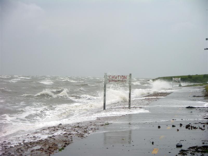
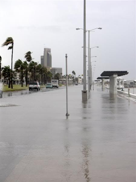
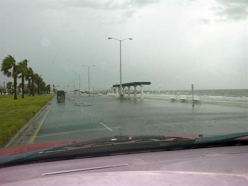
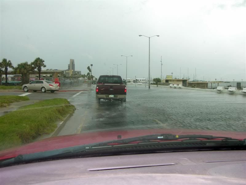
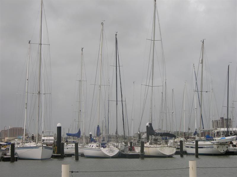
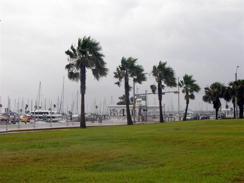
Hi all, There was lots of wind, heavy rain, and little damage to anything. I was able to get out and go everywhere I wanted; however, there was no beach access on Mustang Island as high tide was rather high  .
.
The wind did blow water underneath some shingles and it looks like that part of my roof will need repair. (It could have been much worse!)
Pictures from Wednesday and Thursday...
Corpus Christi Bay seawall at Cole Park
Corpus Christi Bay breaching the seawall headed into downtown


The wind did blow water underneath some shingles and it looks like that part of my roof will need repair. (It could have been much worse!)
Pictures from Wednesday and Thursday...
Corpus Christi Bay seawall at Cole Park
Corpus Christi Bay breaching the seawall headed into downtown
October 19, 2009 Application Mailed
October 26, 2009 PIN issued
January 19, 2009 Application Completed - license issued
January 22, 2010 License In Hand
October 26, 2009 PIN issued
January 19, 2009 Application Completed - license issued
January 22, 2010 License In Hand